 |
||
|
MENU
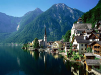
Austria Egypt | Europe In northern Europe bordering the Arctic Ocean and its seas - Kara, Barents, White, Norwegian, west and south - the Atlantic Ocean and its seas - the Baltic, Nordic, Irish, Mediterranean, Marmara, Black, Azov, in the east and south-east edge to Asia more often in proportion to the eastern foothills of the Urals, in proportion Emba River to the Caspian Sea and the rivers Kuma Manich the mouth of the Don. Extreme point of continental Europe, in the north - Cape Nordkyn, 71 ° 08 'Mon sh., on the south - Cape marks, 36 ° Mon sh., west - Cape Destiny, 9 ° 34 'sx. on the east - eastern foothills of the Polar Urals if Baidaratskaya Bay, 67 ° 20 'ex. etc.
To Europe are islands and archipelagos, the largest of which is the New Earth, Franz-Josip (Cape wing for Rudolf Island - the northernmost stop of Europe, 81 ° 49 'Mon lat.), Svalbard, Iceland, UK, Zealand, Balearic , Corsica, Sardinia, Sicily, Crete.
Within the marked area of Europe, together with the islands takes about 10 million km ² area of the islands - okoloo 730 thousand km ². In Europe is divided into three major parts: the eastern, western and central Europe. Coast share of other parts of the world Europe is allocated the largest dismemberment shoreline: 1 km of its length is about 246 km ² area.
The total length of the coastline - about 38 thousand kilometers. About 25% of Europe are the peninsula: Kanin, Kola, Scandinavian, Jutland, Brittany, Iberian, Apennine, Balkan, Crimean.
The southern and south-eastern shores of the North Sea, some parts of the southern coast of the Barents Sea are wadded (sustainer) type, which is formed in low coast time impact of tidal movements of the sea. In other areas, dominated by relatively strong, tightly dissecting tectonic coast: Relief coast of the Kola Peninsula to the north shore folded Iberian Peninsula, somewhere processed by ancient glaciers (fjords and rocky shore Norwegian Sea, northern Baltic Sea coast of Scotland and Iceland) in impacts Marine aggression (coast of the peninsula of Brittany, Wales, western Ireland, north west of the Iberian Peninsula, Dalmatian coast to the Western Balkans).
The main features of the relief means (about 300 m) and maximum (4,807 m Mont Blanc in the Alps) height of Europe - drugimoe inferior parts of the world except Australia. About 60% of the surface of Europe is to a height less than 200 m (partly below sea level: the coast of the Caspian Sea - 28 m, some coastal areas of the North Sea and Baltic Sea), 24% - from 200 to 500 m, 10% - from 500 to 1000 m , 6% - more than 1000 m (thus 1.5% - above 2000 m).
Such a division of the surface height maps dominance in Europe of flat relief. Almost all of Eastern Europe and the northern part of Central Eastern Europe occupy (Russian) field and its extension to the west - the Middle Plain, large areas are plains in Fennoscandia. In other areas, the plains are interspersed between the mountains (Serednedunayska, Nizhnedunayska all others). In the far eastern stretch Urals, on the north west - the Scandinavian mountains.
Band of small mountain altitudes covers the southern part of Central Europe: Central French array, the Vosges, the Black Forest, the Rhine Slate million all others from the south, this share is framed by the highest mountains in Europe - the Alps and the Carpathians. Mountain relief predominates in Southern Europe: the Pyrenees, Andaluzki mountains of the Apennine Mountains, Stara Planina, Dinaric mountain Rodopi, Pind, and others.
Mountain structures in southern Europe (Andaluzki mountains of the Apennines, the Alps, the Carpathians, the Balkans, the Crimea all others) belong to the Alpine geosynclinal (folded) region. Within the Alpine orogen have peculiar depressions, which are characterized by a close to the oceanic crust perishable type of structure (partially submarine well the South Caspian, the Black Sea, the Tyrrhenian all others). According to geophysical data they firmly reduced (or no) "granite" discharge and crust generally has a thickness of about 20-30 km.
Different kind of terrain in Iceland, which shows the level uneven basalt plateau with the fitted for them domes and cones of extinct and active volcanoes, though often buried glacier ice common forms of relief.
|
Google AdSense
|